Journeys without maps: on paths and signs
The second in a series about maps, and the absence of maps
The two of us are walking in the Peak District. The game is this: one person looks at the map in the morning, memorises the route, and leads the way. The other person keeps hold of map and compass, tracks where we’re going on the map, and yells if we go wrong.
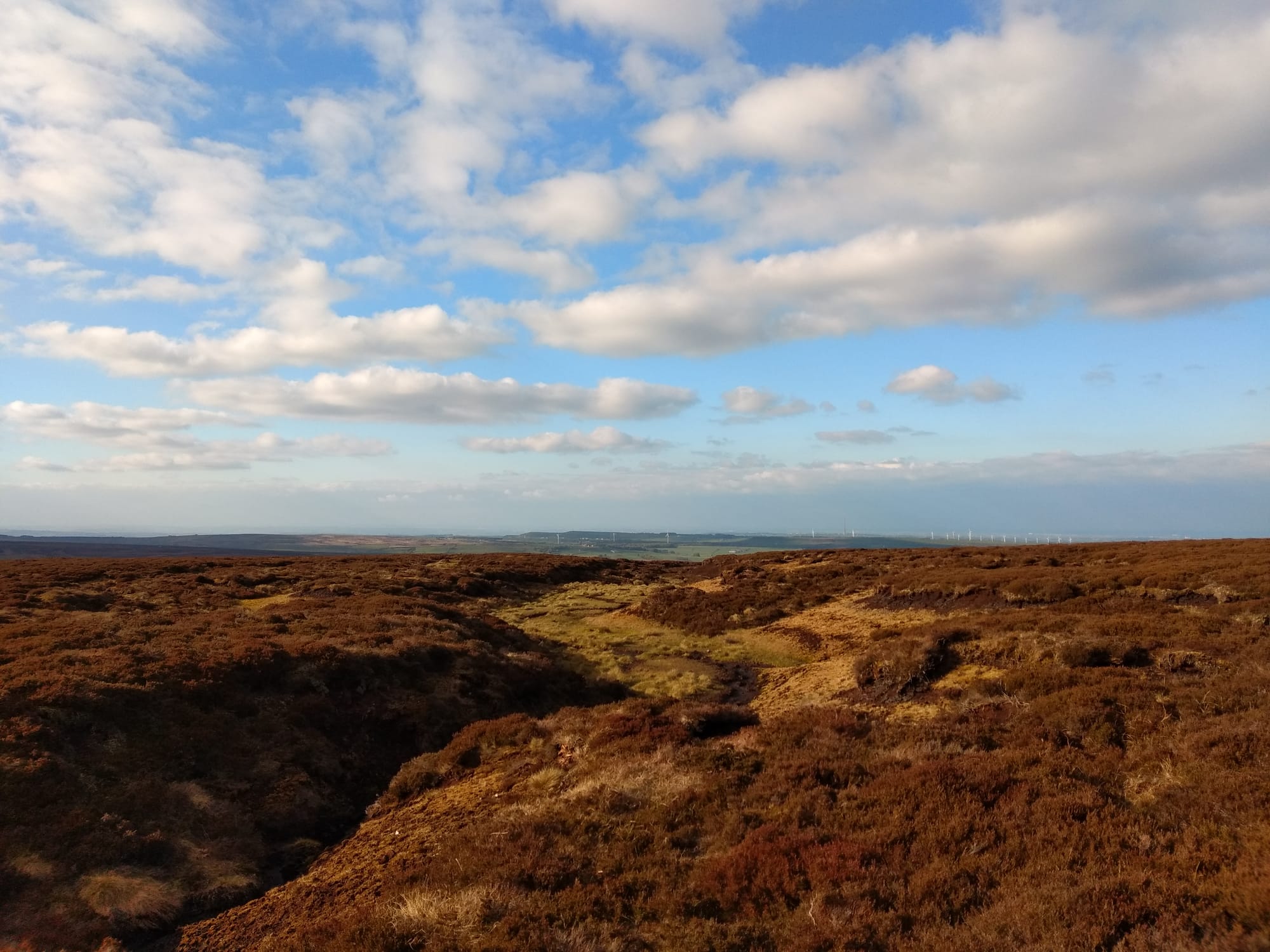
Day one is a breeze. We’re following a ridgeline: along White Edge, then down and up to Burbage Moor, along Stanage Edge, down again, and up onto Derwent Edge. It’s a clear day, and the natural highways of the gritstone edges couldn’t be plainer; the landscape is easier to read than the map. The leader steps out confidently, and on the one occasion when the guy with the map sounds the alarm, it’s the map-reading that’s at fault: we’re on the right route, and on we go.
The next morning, we swap over. It’s a foggy morning, and we are traversing featureless moorland. The game lasts about five minutes.
Journey Without Maps is the title of Graham Greene’s 1936 account of a four-week overland trek from Sierra Leone through the interior of Liberia. I remember it as a meandering and deeply atmospheric book; it left a mark on me and yet I can recall almost nothing that happens in it.
There is no particular point to the journey; it’s a chronicle of boredom and arguments with porters and endless glasses of whisky. Places and people blur into one in an impressionistic way: it tells you nothing but it makes you feel something. It is, of course, a product of its time; it is very much a hunt for danger and mystery and darkness and all the other exotic products of a European’s fetishised Africa—but no great adventures are forthcoming; the biggest dangers seem to lie in the traveller’s own weakness and lassitude. Naturally, then, it is a journey of the soul just as much as it is a journey through a physical landscape: but I now find I can’t tell you much more about the route or destination of that introspective travelogue than I can about the names of the villages Greene passes through in Liberia.
It is—if I remember correctly—illustrated with a map.
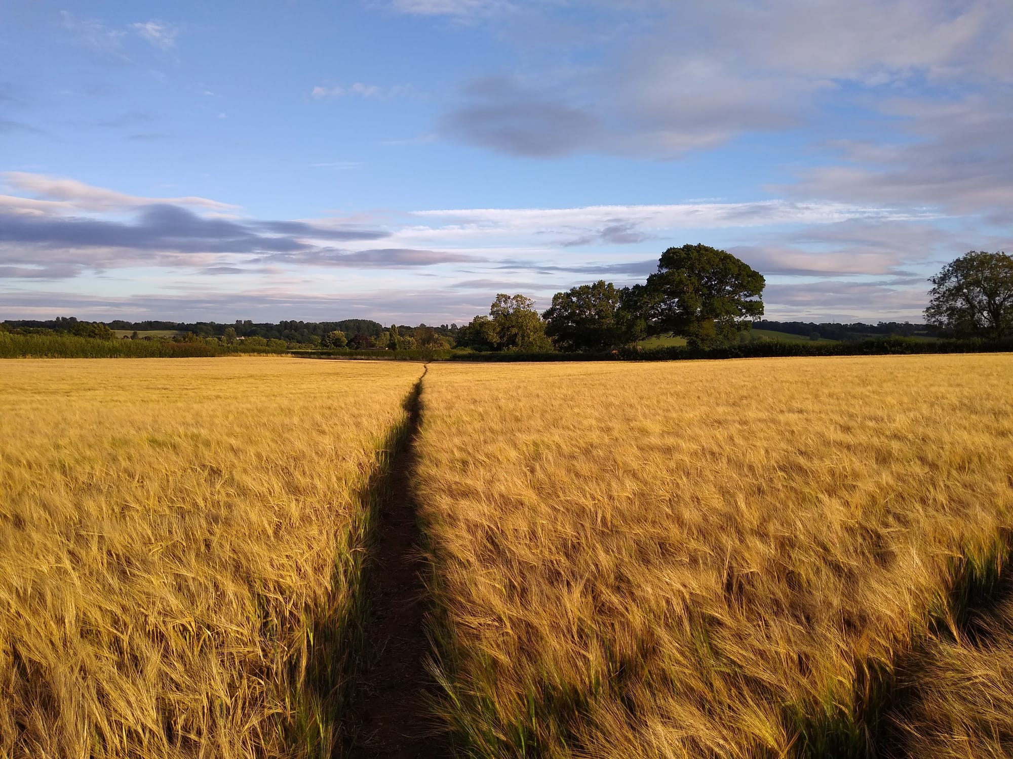
The next time I try doing a walk of any length without a map, it’s a summer’s day in the Weald of Kent. I have picked two train stations as my starting and finishing points, and I need to head approximately southeast to get from one to the other. I will walk for a day, in that general direction, and see where I end up. The weather is clear, so I should be able to get my bearings from the sun. I’ll camp overnight, then use my phone to find out where I am in the morning, and get myself home.
It sort of works, but it’s quite annoying: it’s a lesson in how hostile the English countryside can be to aimless walkers. National trails and waymarked local routes are fine, but away from them, finding a reasonably pleasant route without any forward planning is a constant struggle.
Footpaths disgorge perpendicularly onto busy roads with no sign of how or whether the route can be continued on foot. Where rights of way do exist, they are often impassable: whether it’s down to natural processes, carelessness, or deliberate design. A path is buried altogether under nettles and brambles. Crops get sown with no passage cleared through the middle. A footpath enters a farm, but then the signage runs out in a labyrinth of hedges and locked gates.
By mid-afternoon I am muddied, scratched and nettled, and I have very little idea of how much progress I have made. I follow one marooned footpath that joins a lane leading through a country estate; the gate is secured by a chain, and there’s no stile, but I’m fed up, so I climb the gate and carry on up the lane. A few minutes later, the landowner breaks off from showing a tour group around, in order to give me a furious dressing-down for my act of trespass: he is evidently happy to share the delights of his rural domain with members of the public, but by appointment only, and presumably for a fee.
I pitch my tent in a thistly corner of a nondescript field, out of sight of houses but well within earshot of a noisy road, acutely conscious that there might have been any number of better campsites to choose from if I’d had a map to help me scope them out.
In the morning I switch on the GPS. It seems I’ve headed pretty much due south rather than southeast, and after seven hours of walking yesterday, I’m about ten miles from my starting point. I work out the shortest route from here, follow it without incident, and catch a midday train home.
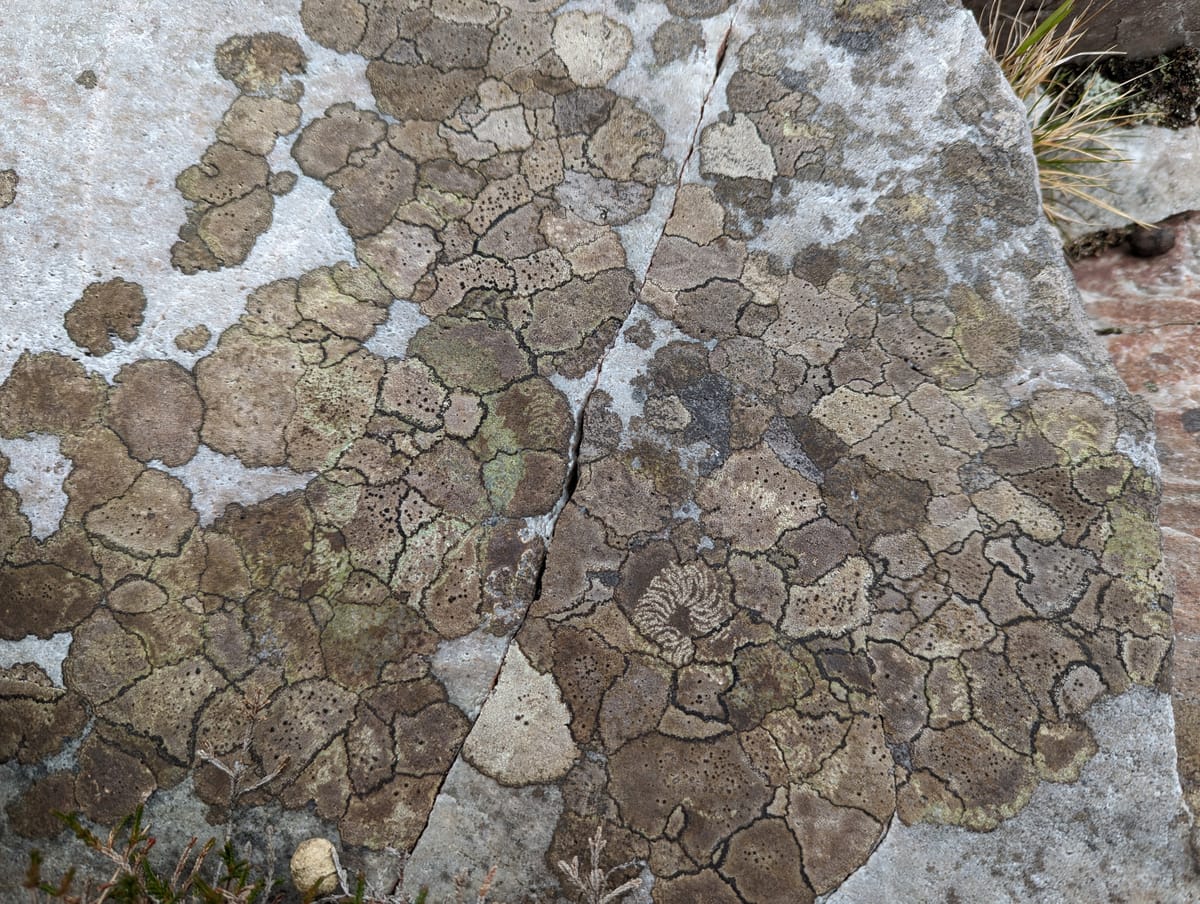
Tristan Gooley has made a career out of writing about what he calls ‘natural navigation’: the art of getting where you want to go without the aid of maps, compasses and other newfangled bits of kit. His tricks for reckoning direction and distance make for enjoyable reading even (or perhaps especially) if you have no intention of relying on them in practice. In order to be able to deduce a compass bearing from the shape of a tree, you need to learn how trees respond to the influence of the sun, the prevailing winds, the slope of the land, and the other features around them. From knowing which way satellite dishes point, and reading the flow of a crowd at rush hour, to understanding the phases of the moon and the way mud behaves on a footpath, the interesting thing about all of Gooley’s navigational wheezes is that they rely on recognising patterns in the world around us, patterns that might otherwise be easily overlooked. And the evolution of his book titles over time suggest that he, too, is well aware that when he explains how grasses bend in the wind or how moss and lichen develop on rocks, he’s not peddling navigational tools so much as ways of connecting with the natural world.
That’s not to say that his tricks are useless when you’re trying to find your way. But in the years since I first read one of his books, I have noticed that understanding the theory is only the beginning. The clues you’re looking for rarely present themselves in textbook format at exactly the moment you’re looking for them. There is, I am sure, no substitute for long experience in reading the signs of the natural world. In the absence of that experience, close attention is needed and—more than anything—patience.
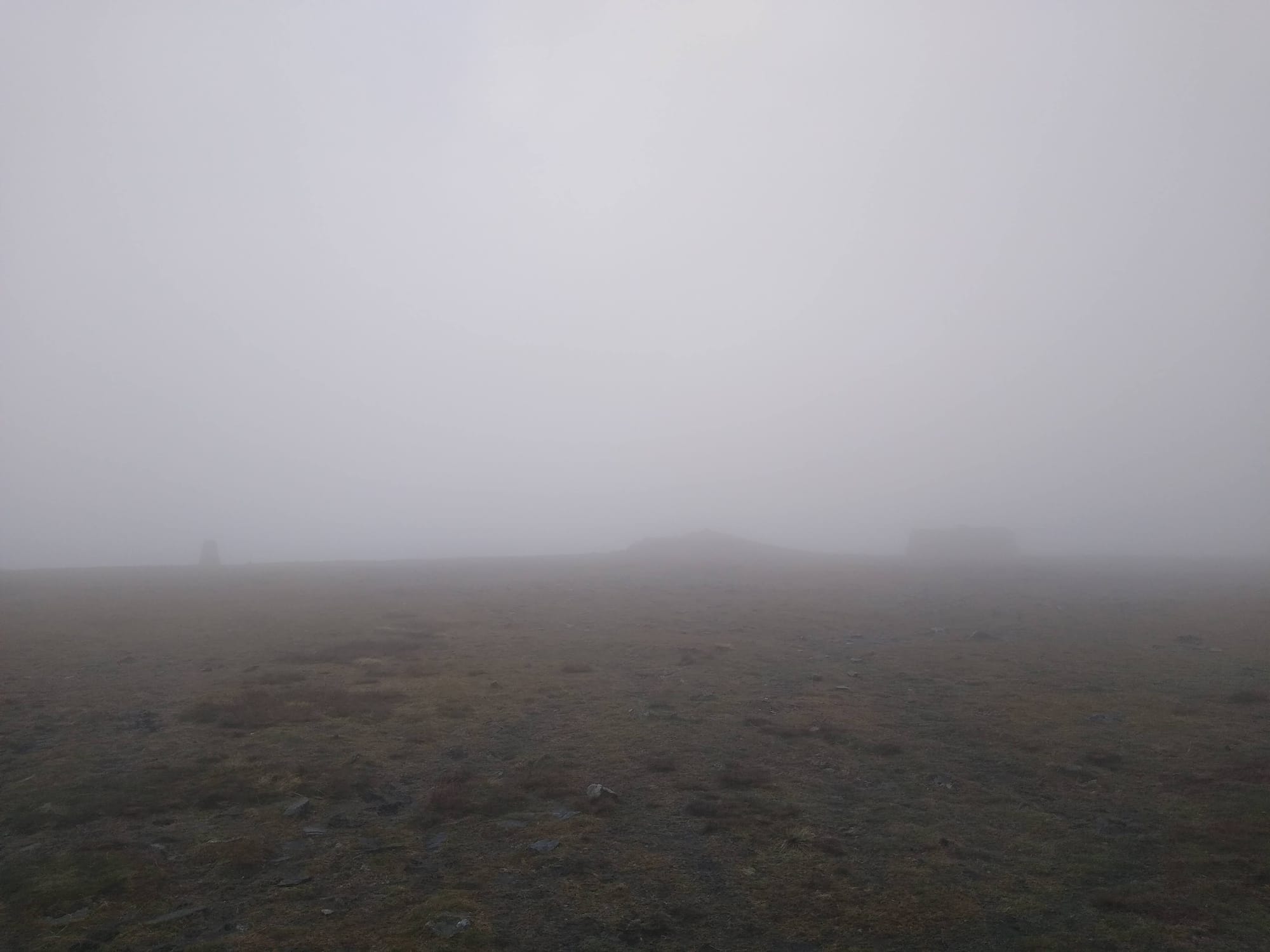
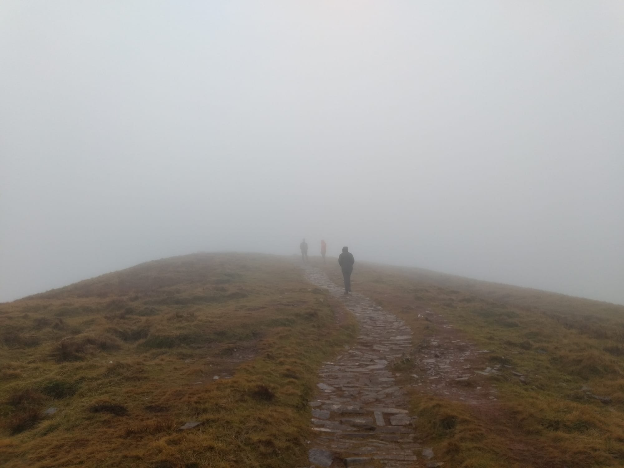
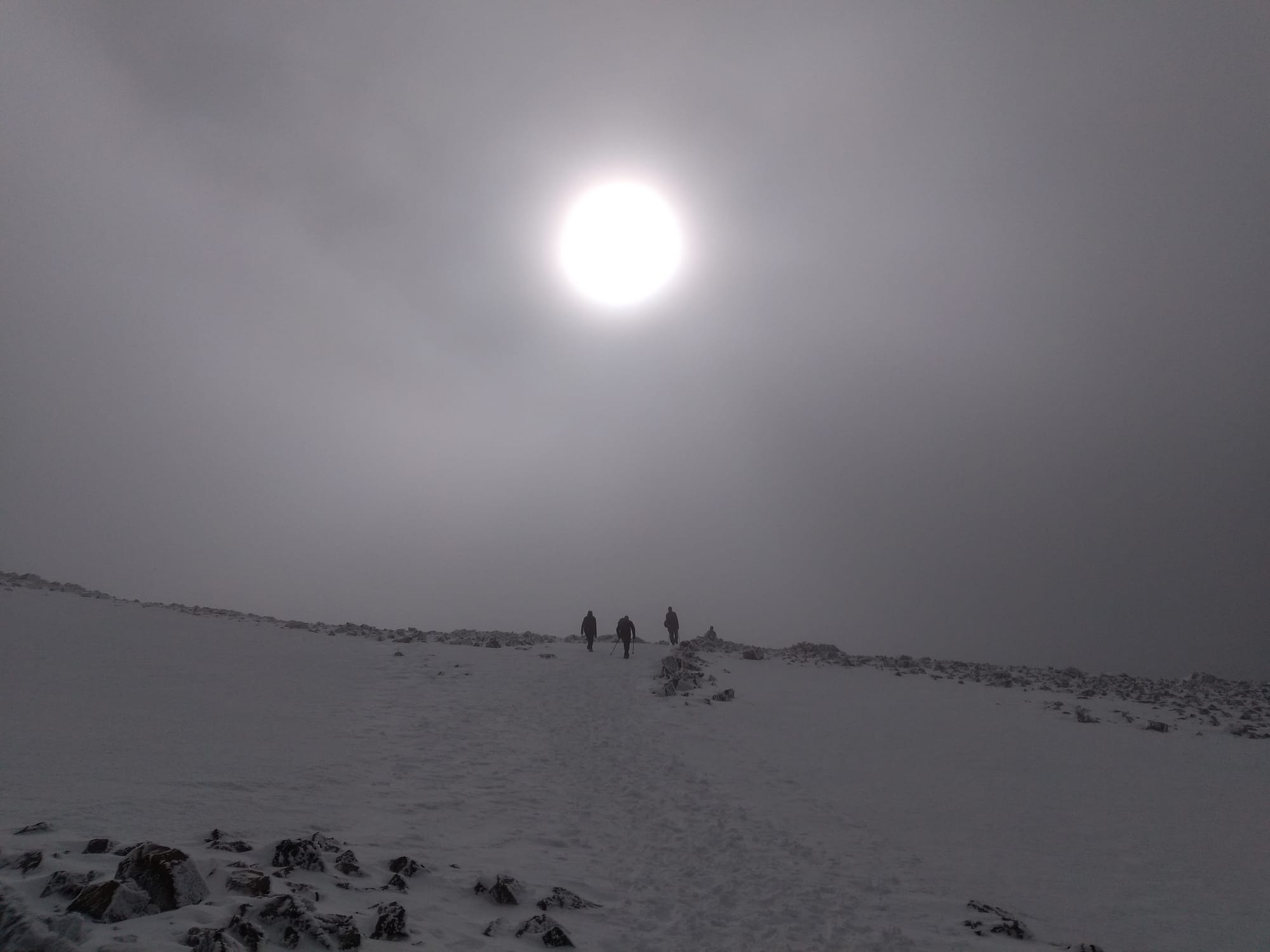
Navigational challenges: fog on the summit of Ingleborough, near Grimspound on Dartmoor, on Pen y Fan, on Ben Nevis, and on Beinn A'Chróin
I read Greene’s Journey Without Maps roughly ten years ago. It seems incautious to venture my thoughts on a half-remembered book—especially one by such an illustrious writer—without consulting it again. But I have resisted going back to it: for once, it feels appropriate to stumble around among my own hazy memories without recourse to the navigational aid of the text itself.
It must, I am sure, be a carefully and artfully constructed book: I don’t for a moment believe that Greene just spilled out a series of unstructured thoughts and recollections and declared, ‘that’ll do’. But in my loosely remembered version, the structure is deeply buried: or perhaps it would be better to say that, like the world around me, the book contained patterns I didn’t know how to read. Journey Without Maps differs from most of the classics of travel writing in the sheer purposelessness of the journey, and the lack of any apparently significant destination or climax. Most journeys have an identifiable outward leg and a return, even if they don’t end exactly where they started. There’s a watershed somewhere, a point from which it’s all downhill. I don’t remember that at all in Greene’s journey. He’s travelling; things happen along the way, or don’t; and then he’s finished.
I do remember quite vividly a passage near the beginning when he’s talking about his youthful fascination with Africa, and his reasons for wanting to plunge into the depths of this continent ‘roughly the shape of a human heart’. It’s as clear a statement of intent as you could ask for: this is to be a journey of self-examination more than one of geographical discovery. But, as I said before, my recollections of what Greene learned about his soul are no clearer than my recollections of where he went and what he saw.
I know that he walked a long way, and that conditions were often unpleasant: heat, mosquitoes, the usual sort of thing. He had innumerable arguments over pay and conditions with the dozens of porters he had engaged to carry his baggage. He became very bored. He met the President of Liberia, who appears to have been extremely affable and not particularly busy. He drank a lot of whisky. He travelled with his cousin Barbara, but had very little to say about their interactions. He witnessed some ritual magic. He fell ill. He reached the coast, and went home.
Was he a different person by the end? What did he learn about himself? These things must be important but perhaps they are also incommunicable. Or perhaps I missed the signs by the wayside.
On that frustrating mapless walk in Kent, I regarded my experiences with blocked paths and disrupted walking routes as a collection of largely isolated incidents: a lack of foot traffic here, an unscrupulous farmer there, and maybe a lack of exertion from a few parish councils. But The Lost Paths by Jack Cornish, which came out last year, offers a reminder that (as usual) history is everything, and there are patterns everywhere. ‘Modern journeys along ancient footpaths’ is the subtitle, but ever-present are the ghosts of journeys that can no longer be made, because of the ways in which turnpikes or railways or land enclosure have changed the ways we walk over the centuries, and left countless routes obliterated, or barred to the public, or turned into busy paved roads with nowhere to walk.
A bigwig at the Ramblers, and formerly their Head of Paths, Cornish knows the rights and wrongs of rights of way better than almost anyone. No doubt he would have shared my frustration at the impassable paths and lost routes that confounded me in Kent: and he might have been better equipped than me to find a good way through. So too, of course, would Gooley the natural navigator. But the guru I find myself really wishing I could walk with is a man called Speedy, who appears briefly in Henry Shukman’s memoir One Blade of Grass.
A tramp[1] of the old school, Speedy is a regular and welcome visitor to the house where Shukman grows up, and divulges occasional hints of the lore he has gathered in a lifetime on the road. He says that there are routes by which a person on foot can cross the English countryside without difficulty: ancient routes unmarked on any map, but clear as daylight to those few who still know how to find them.[2] The existence of these routes, hidden in plain sight, becomes a metaphor for the Zen practice at the centre of the book: a way that is utterly simple and yet impossible to mark out in writing; a way that runs beside us all but remains invisible to most of us; a way that can only be found by walking it.
There’s something very seductive about the idea of these mysterious ways: a path understood not as a walking surface or a legal right of way, but a matter of knowledge and practice. A route, not of gravel or tarmac, but of insight. As befits someone in the earliest stages of Zen practice, intrigued but very inexperienced, I find myself half-believing Speedy: I want these routes to be there, all but unknown to the Ordnance Survey, or to the Ramblers. I want to follow them. I don’t know how to find them, but I would like to learn.
On his journey through Africa and the human heart, Graham Greene suffered much greater inconvenience (if I remember rightly) from the absence of paths than he did from the absence of maps.
It’s easy to think of paths merely as things that make it easier to get to your destination, on the assumption that you already know where you’re going. But a path also tells you where to go in the first place. It’s not just the surface of a route; it’s a sign that the route exists. A path can appear on a map, but it can also remove the need for one.
When I plan a walk with a map, I tend to decide where I want to go—this hill, this lake, this camping spot—and then look for the paths that will make a viable route between them. Trying to do the same thing without the benefit of a map is, it turns out, difficult and frustrating. But perhaps the fault is not in the lack of a map, but in the insistence on specifying the destination. A better way to walk might be just to follow the paths that look attractive or promising in any given moment, and trust to the patterns of the landscape to deliver me wherever they will.
I try some aimless walks.
Crossing central London, an area I thought I knew pretty well, I make a couple of turns down streets I haven’t followed before, away from the main thoroughfares, and soon lose my bearings completely among squares and alleyways I never knew existed, nestled somewhere in Holborn or maybe Clerkenwell—I still don’t quite know where. I carry on, astonished at how long it takes me to emerge on a familiar main road. In a small repurposed churchyard, a green oasis I’d never heard of, I stop on a bench made from tombstones. A maple pulses with the zesty green of springtime. I feel an unexpected affection for a city I no longer call home.
I take long walks in Sheffield, accompanied by a baby in a sling or a pushchair. I am trying to get to know the city, and in parts, I do: but I don’t feel as though I know it, because I haven’t translated my 3D knowledge back onto a 2D map. I realise that, walking without a map, I am seeing the city without laying claim to it. It’s only by noticing how strange this feels—the experience of discovery without cartographic possession—that I become aware of the subtly acquisitive nature of every other walk I have ever done. There has always, always been a sense of taking hold of a place, pinning it down on paper. The act of cross-referencing map and landscape is a way of saying, ‘Yep, got this. Mine.’ I didn’t know it, but I had been marking territory all my life. I feel a new shame, as though I have just realised that I have pissed on every street I have ever walked.[3]
I wander around on Edinburgh’s Costorphine Hill. It’s easily big enough to get lost on, but not big enough to make you worry about being lost. Besides, there are waymarkers, stone pillars about three feet high, with laconic directions on them: they don’t list all the places that a path might lead, just the next place along the itinerary. One by one, I can follow them back home. ‘Clermiston Road.’ ‘Queensferry Road.’ ‘Tower.’ ‘Rest & Be Thankful.’ ‘Ravelston.’ If you know the overall shape of the route, you’re fine. If you don’t, you’re stuffed. On paths that wind through mature woods, I lose my bearings constantly, and whenever a view of the city opens up, I’m invariably surprised to find which direction I am facing. But I don’t need to know which way is north. As long as I follow the signs, all will be well.
If life is a journey without maps, I wonder how all these different landscapes correspond to its different stages, and the different things they throw at us. The ridge walk with its clear edges on a sunny day—the flat and foggy moorland—the pretty countryside full of blocked routes and paths to nowhere. The city you thought you knew—the territory you tried to claim—the woodland in which you barely knew which way was up, but there were signs to guide you home.
If Journey Without Maps refuses to deliver a conventionally satisfying narrative arc with a clear resolution at the end, I suspect it has less to do with the lack of a map than the lack of a goal. Most travel narratives are pilgrimages of some kind, religious or secular, and (as I’ve suggested in another essay here) even if it eventually turns out that the value lies in the journey rather than the destination, writers and readers are generally expected to start from the assumption that the destination counts for something. Not so with Greene: from the very first step he takes, together with his long-suffering cousin, the only real objective is to go on until, reaching the sea, they can go no further. And if the journey is a chronicle of his own consciousness, he is too scrupulous to fit it all into a neat package of straight lines and logical progressions. All books, like all maps and all pictures, distort what they purport to represent. Orderly composition and precise brushwork often signal more distortion, rather than less. Greene’s book—or at least, my remembered version of it—is blurred and almost shapeless, no sharp outlines, but it gives you a sense of something.
Still, not every journey has to be aimless. For instance, on an established pilgrimage route you don’t generally need a map, but you have a path, and some waymarkers. Whether it’s the scallop shells of the Camino de Santiago, or the Stations of the Cross, or the shrines along the many routes of the Kumano Kodo, the trail is well marked, and besides, there are other people going the same way, so all you need to do is follow them.
One of the conclusions I drew from Henry Shukman’s Zen memoir, in which we met Speedy the Tramp, was that there is no readable map for the spiritual journey he is on: but there are waymarkers in the form of the koans that he studies, one by one, and that help to chip away at the delusions separating him from awakening. And there are teachers: other people who know the way, and can help direct him stage by stage.
Another way of looking at a map is as a prop for the pretence of self-reliance: I’ve got the information, I know where I’m going, I can do this. But if you’re looking for a route that you can only follow with someone else’s help, then the map might be the thing that keeps you lost.
You have to lose it in order to find your way.
Cornish chews over the discomfort associated with using the word ‘tramp’ today. He continues to use it, without derogatory or offensive connotations, as a description of the itinerant twentieth-century homeless person, dependent on some combination of occasional labour, petty trading or begging, and the ‘casual wards’ of workhouses, which provided food and temporary shelter in exchange for manual labour ↩︎
These routes also crop up in Cornish's account, featuring as a long-standing fixture of tramping lore. But he cautions, wisely, against romanticising the figure of the tramp. Speedy appears in the Shukman memoir as a symbol of freedom, of independence from authority and social pressure, but historically most tramps were forced into their lifestyle by poverty and an unjust social system. It was a gruelling existence, combining the hardship of life on the road with widespread ill-treatment, chronic poor health, and a tragically high suicide rate. ↩︎
In Maps are Territories (1987) David Turnbull analyses the power dynamics in mapmaking in much more detail, in the context of the differences between Western and Indigenous understandings of the world. This deserves more than a footnote and I hope to come back to it... ↩︎
Sources:
Graham Greene, Journey without Maps (Heinemann 1936)
Jack Cornish, The Lost Paths (Penguin 2024)
Tristan Gooley, The Walker's Guide to Outdoor Clues and Signs (Hodder & Stoughton 2015); The Natural Navigator (Ebury 2020)
Henry Shukman, One Blade of Grass: A Zen Memoir (Hodder & Stoughton 2021)
These are affiliate links to Bookshop.org: I receive a 10% commission on any purchases via these links, and another 10% of the sale price goes to support independent bookshops.
Images:
All photos are by the author, except the final one: Jacobeo, public domain, at Wikimedia Commons.